THUNDER BAY — Winter is poised to arrive early in a broad swath of Northwestern Ontario, but Thunder Bay and other locations close to Lake Superior are more likely to get a lot of rain.
Environment Canada says it all amounts to "a messy mix of weather."
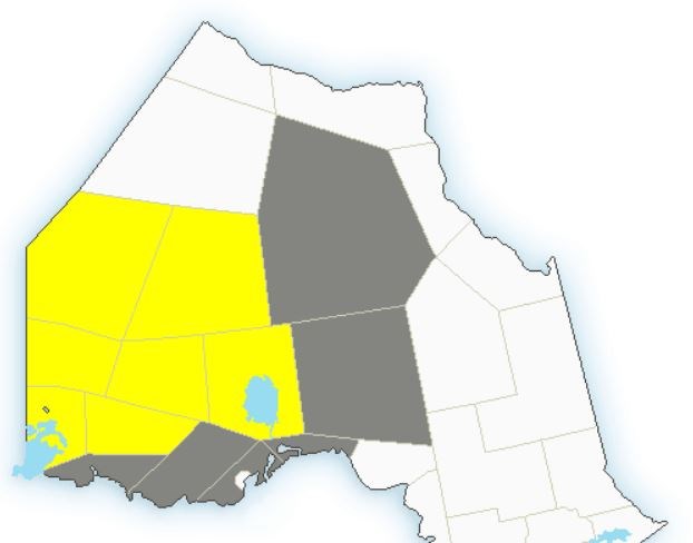
The agency has issued Winter Storm Watches or Special Weather Statements for areas between the Manitoba border and Greenstone.
Snowfall accumulations totalling 25 centimetres to 50 centimetres are possible by Friday evening in many locations.
In Superior West, which includes Whitefish Lake,. Arrow Lake, Kakabeka Falls, Cloud Bay and Dorion, inland snow accumulations will likely be a lot less, from 5 to 15 cm.
Rainfall amounts in the City of Thunder Bay, however, could be very significant – in the 30 to 50 mm range.
The source is a developing low pressure system that's expected to bring a mix of snow and rain beginning Wednesday afternoon, intensifying early Thursday, before the system begins to ease throughout the day on Friday.
Environment Canada says the snow will be accompanied by strong wind at times which could result in reduced visibilities, especially on Thursday and possibly Friday.
Snowfall warnings may be issued as the system draws nearer to Northwestern Ontario.
NOTE: This story has been updated to include revised forecasts in effect late Tuesday afternoon
