The sun will come out tomorrow.
Friday’s spring storm brought high winds, blowing snow and terrible driving conditions and it isn’t expected to clear up until the day is over.
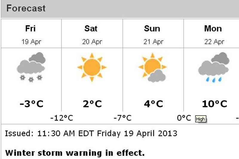
But Environment Canada meteorologist Geoff Coulson said there is plenty of sunshine in the forecast for Saturday, although temperatures are expected to remain cooler than normal April weather.
The storm that hit the city Friday is a powerful system affecting the entire province, Coulson said.
It brought significant thunderstorms to southern Ontario Thursday and a possible tornado to a small town northwest of Toronto.
The storm is also slow-moving.
“It’s sitting over the east end of Lake Superior right now only moving very slowly. The conditions of snowand blowing snow are expected to continue for much of the rest of the day before things start to improve,” Coulson said.
Environment Canada had predicted on Thursday up to 20 centimetres of snow would fall on the city by Friday evening.
And while many people had to dig their vehicles out of their driveways, Coulson said the high north winds have made it challenging to tally how much snow the city has received so far.
The end also isn’t necessarily near.
“I wish I could say this is the last shot,” Coulson said.
The forecast notes cooler temperatures for the coming days, which means instead of rain, the area could see more snow.
Temperatures usually see a high of about 11 degrees Celsius this time of year. Monday may see a high of 10, but the rest of the coming week is expected to be cooler.
But there is also a fair amount of sunshine in the forecast.
While this amount of snow in April isn’t record-setting, Coulson did say the number of snow falls is unusual.
“It’s definitely the most snow that Thunder Bay’s seen during the month of April for the last few years. It’s not unheard of. It’s been this idea of one storm after another,” he said.
