THUNDER BAY - Property owners along the Kaministiquia River were provided an opportunity to learn about the risks that may be associated with increased water flow and the potential for flooding along the waterway.
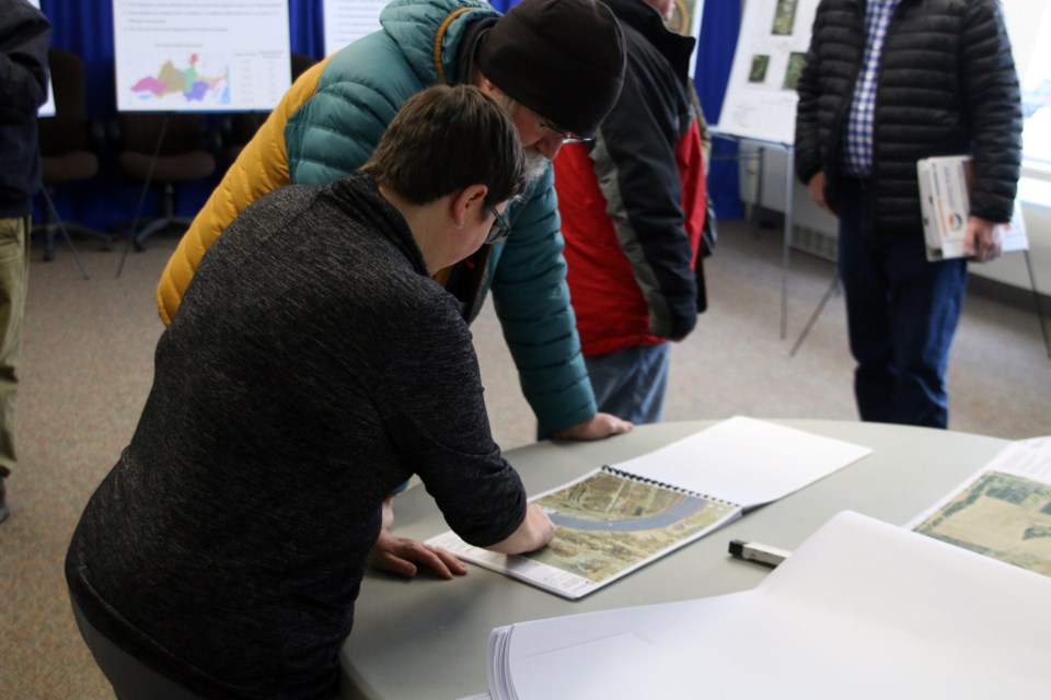
The Lakehead Region Conservation Authority hosted an open house on Thursday for property owners along the river with information on its updated floodplain mapping.
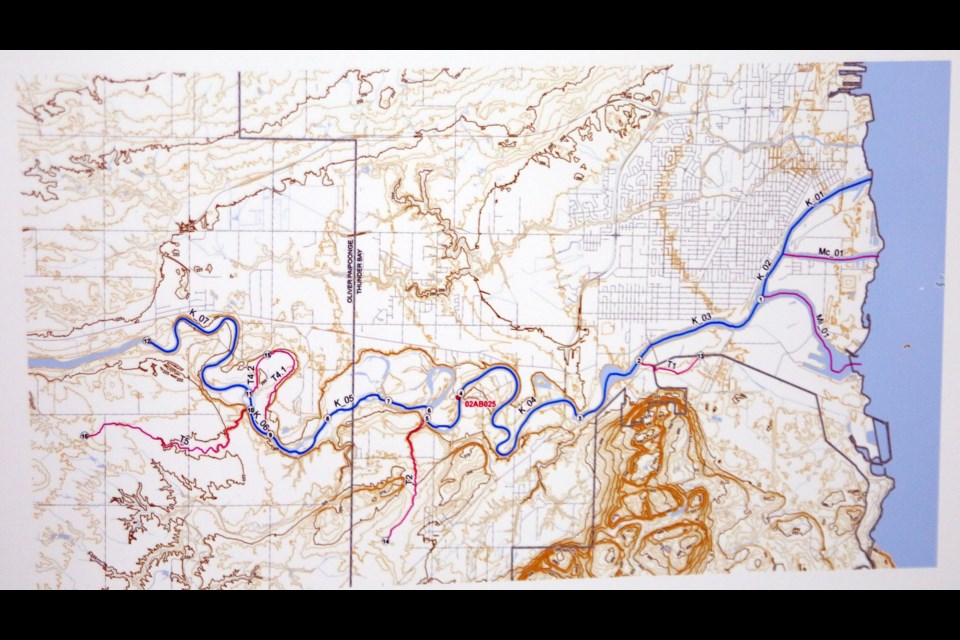
“We are updating the 1979 study that delineates the floodplain on the Kam River,” said Tammy Cook, chief administrative office with the Lakehead Region Conservation Authority. “It’s been many years since we’ve done this study and the study has used many different new technologies like LIDAR to determine the digital elevation model and updated modelling techniques to determine what is the 100 year floodplain on the Kam River.”
The new mapping shows that there is an increase in water flow coming down the river and is estimated to increase in the next 100 year period.
“We’ve had many huge storms on the Kam River so that all plays into the statistics that are used to determine how much flow is coming down in the 100 year floodplain,” Cook said.
The floodplain mapping has not been updated for more than 40 years because of a lack of funding. But Cook said now that funding is in place, the Kam River is one of four waterways being updated, including the McIntyre/Neebing Rivers, McVicar Creek, Pennock Creek, and Mosquito Creek.
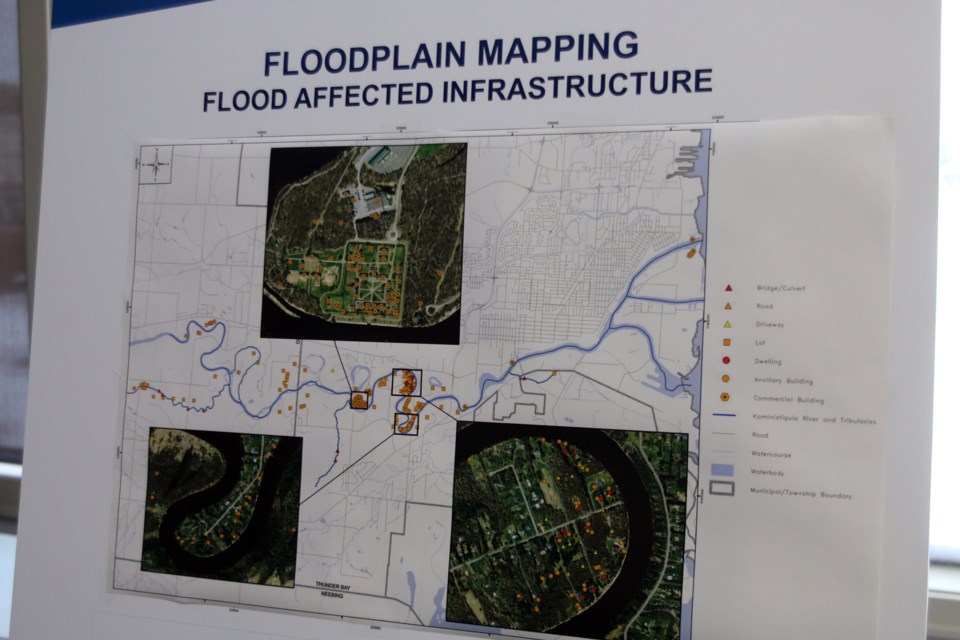
“The importance of the floodplain mapping is we use it for regulatory purposes,” Cook said. “We administer regulations that determine where people should build their houses for instance and where to direct people away from the hazard. The key point is to keep them out initially than having to rescue them in times of flooding.”
The more than 300 people invited to the open house received a map in the mail and Cook said most people coming in are looking for clarification on what the 100 year floodplain means for their property.
“We will take all comments we receive and look at them if there are any discrepancies before we finalize the study,” she said.
And while water flow is increasing on the Kam River, Cook said the actual floodplain has not changed by much.
“The floodplain has increased to some degree,” she said. “That doesn’t mean the floodplain didn’t exist previously, we just updated our mapping with our updated technology to show what was actually going to flood. There has been an increase in some areas. The Kam River is a very big system so the floodplain itself hasn’t changed immensely.”
Open houses are planned for Pennock Creek on Mar. 18 and for Mosquito Creek on Mar. 19. Both open houses will be from 4 p.m. to 7 p.m. at the Lakehead Region Conservation Authority office.
