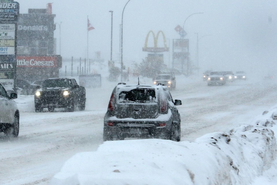
THUNDER BAY — Environment Canada is warning residents in the Thunder Bay area to get ready for more blowing snow and cold temperatures on Friday, as Thursday’s snowfall was already making for difficult conditions on city streets.
Between Thursday and Friday, the area is expected to receive a total of 20 to 40 centimetres of snow, said meteorologist Steven Flisfeder.
Combined with strong gusting winds, that will cause very difficult travel conditions across the area, likely lasting until at least Saturday morning.
“[The snowfall] is going to become a lot more intense and there’s going to be much stronger wind gusts as well,” he said of Friday’s conditions.
The heavy snow should be easing by Saturday, Flisfeder said, but gusting winds of up to 80 km/h could continue to reduce visibility.
Environment Canada is also projecting temperatures will drop as low as -31 on Friday morning with the wind chill, rising to -25 with wind chill in the afternoon.
Northwestern Ontario is on the westernmost edge of a weather system that’s bringing intense winter storms to a large swath of eastern Canada and the United States, Flisfeder said.
“Believe it or not, it’s the least affected area associated with this storm,” he said. “Still very impactful weather, but compared to what’s expected for Southern Ontario, on the tamer side of what could be coming.”
With files from Sheri Leviski-Kotyk, CKPR Radio
