SHUNIAH — Upgrades to a national weather radar system network designed to better detect approaching hazardous storms include a station near Shuniah.
"These modernized radars will significantly enhance (a) forecasters' ability to track and identify severe weather, distinguish between rain, snow, and freezing rain over a long-range, and plan actions to reduce risks," Liberal MP Marcus Powlowski (Thunder Bay-Rainy River) said in a recent online post.
According to an Environment and Climate Change Canada news release, the federal government has spent just over $180 million over eight years to install 32 "state-of-the-art weather radars."
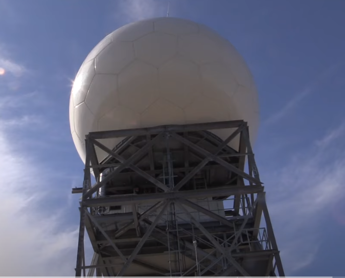
An advanced radar facility near Shuniah is located northwest of the municipality off Highway 527, a department spokeswoman said on Tuesday.
The remotely-operated facility "was completed last summer and scans the sky (daily) for precipitation," she added. "It has a range of 330 kilometres from the radar in its regular mode and 240 km for Doppler coverage."
Doppler radar utilizes microwave signals to gauge a storm's speed and location.
The new systems will enable meteorologists to better track hurricanes and tornadoes and issue warnings about them in a timely manner.
The news release said, "The coverage area of the new radars increased from just over one million square kilometres to over four million square kilometres, ensuring that 99 per cent of Canadians live within 330 kilometres of a Canadian radar."
The Chronicle Journal / Local Journalism Initiative
