THUNDER BAY — Longtime videographer and photographer Alan Auld says he’s been living near Lake Superior for quite a long time and has seen a number of seiches.
But not as dramatic as the one that occurred on Saturday.
A seiche is essentially sloshing on a massive scale. According to the U.S. National Ocean Service seiches happen when strong winds and/or quick changes in atmospheric pressure push water from one side of a semi or fully-enclosed body of water to the other and back — something like one might see at home in a bathtub or swimming pool. Auld, who has a camera on his house that automatically records, posted a time-lapse video of the phenomenon on social media and took photos.
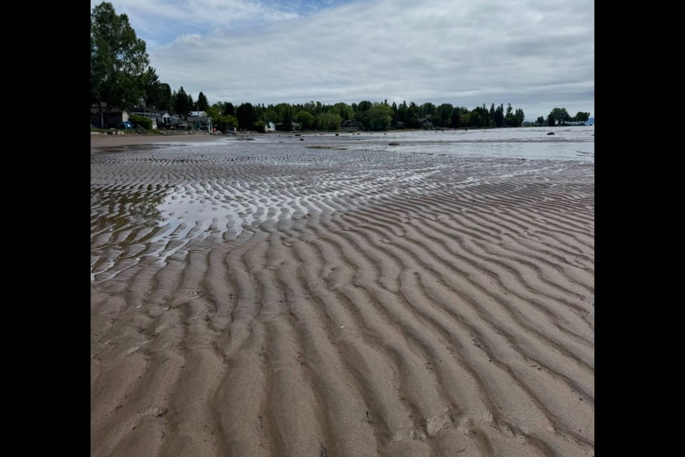
“I got up in the morning and noticed that the lake had receded and I made a joke to my wife, I said ‘who pulled the plug?’ because the lake was out about 50 feet and it happened quite quickly,” he told Newswatch.
“The first time I went out there to take a picture, it was already starting to come back.”
Checking his video footage from earlier in the day showed the lake level dramatically rising before he saw it at a low point, he said.
Steven Flisfeder, a meteorologist with Environment Canada’s weather office, said using data from the United States’ National Weather Service (he said there isn’t the same level of monitoring infrastructure on the Ontario side of the lake), he saw significant and correlated rises and falls in water levels across Superior, indicating a seiche had occurred.
And while atmospheric pressure changes can cause them, Flisfeder said it likely wasn’t the case this time.
“What happened on Saturday seems to be more wind-driven, which is, based on my experience, more common on the Great Lakes,” he said.
“When there's an extended period of time with fairly consistent strong winds, that drives the water surface, again, from one side of the lake to the other.”
Much of Northwestern Ontario saw strong storm activity over the weekend, including tornado watches and warnings west of Thunder Bay, although none were reported to have touched down.
“There was fairly consistent thunderstorm activity Saturday and Sunday, and so with that were very strong wind gusts as the storms were passing through,” Flisfeder said. “That would definitely have been a driving factor with what led to this weekend's seiche.”
Auld said it was dramatic seeing the amount of dry shoreline where he is, just off Lakeshore Drive in Shuniah, suddenly increase by up to 100 feet.
“That's a lot of water that got sloshed around and, yeah, it was huge,” he said, adding that they’re next to a small bay which could have made the effect where he is more intense.
“Where we are though, the water is fairly shallow, so different areas would have different depths,” he said. “Some areas, the water is quite deep and they probably wouldn't notice it as much.”
He said he also heard from people in other cities around Superior, like Sault Ste. Marie and Duluth, who noticed the same phenomenon.
“It was pretty remarkable and kind of an eerie feeling.”
