The Lakehead Region Conservation Authority has upgraded its flood watch to a flood warning.
City worker and firefighters were responded to a number of flood related incidents Monday morning. The LRCA originally issued a flood watch for the city as well as Neebing, Oliver Paipoonge, Shuniah and the townships of O’Connor, Conmee, Gillies and Dorion but has since upgraded it to a warning.
On Monday afternoon Fort William First Nation Chief Georjann Morrisseau declared a state of emergency under the Emergency Management and Civil Protection Act, stating the community has suffered flooded homes and roads have been washed out.
The city and area has already received about 50 to 60 millimetres of precipitation over the last 24 hours. Another 45 millimetres of additional rain is expected in the forecast over the next day and overnight.
LRCA chairman Bill Bartley said the amount of rainfall may even be exceed in the event of a thunderstorm.
“We’re telling people to be careful and watch out,” he said. “It’s not as bad as last year. We still have lots of room in the waterways but 28 or 30 hours from now that could be a different story. If it keeps going the way it is right now it should be OK but I say that with great caution.”
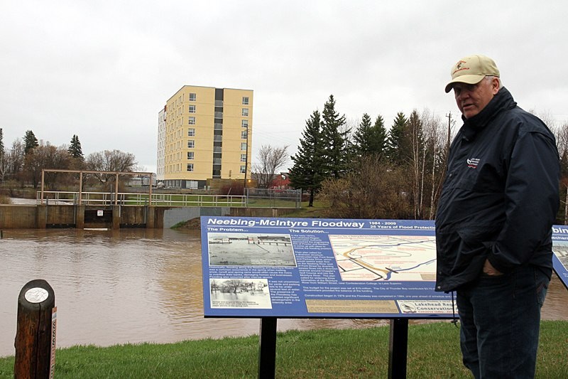
Water was already overflowing onto the street along Mountain Road near Broad Oaks Drive, which is now closed. The Neebing-McIntyre Floodway has also begun diverting flows and is expected to continue over the next few days.
Bartley said they are monitoring the situation closely and advised residents to stay away from fast flowing water in watercourses and in ditches and added that they are in close communications with the Ministry of Natural Resources.
“We haven’t had any reports of any great rivers flooding,” he said. “If anything changes we’ll certainly let people know. Right now we’re in fairly good shape.”
OPP Sgt. Brent Genereux said they’re also monitoring the weather.
He said some roads are already seeing some water flowing over but so far, there hasn’t been any road closures yet due to flooding.
Roads that have some water include Highway 527 about eight kilometres from Highway 11/17, Silver Springs Road, Highway 593 and Flanders Road South near Atikokan.
“If the integrity of the road starts going then we will definitely close the road,” he said. “This all depends on the weather.”
OPP later sent a release that listed a number of roads that weren’t passable because they were washed out.
The roads included Highway 593, Auto Road a mile West of Dawson Road, Blakie Road at Whitefish River and Flanders Road to Lac La Croix.
OPP say Highway 527 about eight kilometres from Highway 11/17 is washing out but still passable as well as Silver Springs Road and Two Island Lake Road off Highway 589.
OPP have also closed a section of Highway 11/17 about 48 kilometres west of Nipigon. OPP say a hole in the road forced them to close both sides of the Trans-Canada Highway near Nipigon.
Police are redirecting traffic at Highway 527 and Highway 11/17 and are unsure when the road will be open to traffic.
NOTE TO READERS: If you have weather-related photographs you would like to share, please send them to [email protected].
