The city got its first look at what to do with lands around the Kaministiquia River Monday night.
From the James Street Bridge to the shore of Lake Superior, and McKellar and Mission Island, the Kam River and Islands Land Use Study draft plan is a series of recommendations on how the lands can best be used as historic industrial uses have gone away.
Senior city planner Victoria Kosny said the study, which is still a draft, recommends that the city rezone lands to make way for more recreational and commercial uses. Some of the key recommendations include rezoning land around the James Street bridge to mixed-use residential and commercial and changing land between the railway tracks and the river to make way for future recreational trails as part of the city’s overall 52 kilometre waterfront vision.
The study will help the city decide what to do with the lands in the future. Kosny said as water and land quality improves in the area, the land is environmentally sensitive.
"It could be tomorrow and it could be 20 or 30 years what we want to make sure is that the area is planned for the right things to happen and not the wrong things," said Kosny.
Mayor Lynn Peterson agreed saying the study was not about projects but rather setting up a zoning framework so the city won’t make the wrong choices when it comes to future development around the Kam River.
"All of this is to avoid surprises in the future," Peterson said. "That we didn’t get surprises we didn’t want in the overall plan."
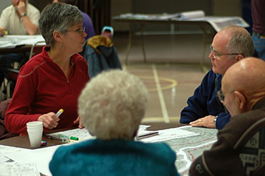
The study was done with the help of public input during a pair of open houses last winter. Kosny said a lot of the public’s suggestions helped develop the first draft she presented to council Monday night.
"We were pretty passionate about making sure that a good deal of that got into the report and helped formulate a lot of recommendations," she said.
The draft plan will be presented to the public at events throughout the summer, including Riverfest, and more consultations and open houses are expected, Kosny said.
