THUNDER BAY – The City of Thunder Bay has outlined a multi-million, more than decade-long plan for a unified waterfront trail connecting its north and south ends.
Achieving that vision will eventually cost more than $20 million, staff estimated in a report presented to city council Monday, and depend on negotiations with multiple private landowners.
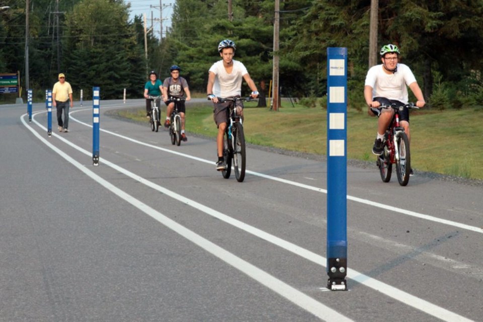
However, work adding kilometres of new trail sections in the Marina Park and Mission Island areas will begin this year.
The multi-use trail would stretch for roughly 13.5 kilometres from Fisherman’s Park at the mouth of Current River in the north, to Mission Island in the south.
The implementation plan comes after Coun. Aldo Ruberto pushed last year for the city to move forward on the plan, first envisioned more than 15 years ago during development of Prince Arthur’s Landing.
Ruberto said he was pleased with the plan presented Monday, arguing the trail would be widely used and should be prioritized.
“It’s probably one of the most important projects in this city,” he said. “Everybody gets to use it – rich, poor, disabled, old, young – it doesn’t matter.”
Coun. Brian Hamilton was more critical, saying the plan would strain limited infrastructure resources and was hobbled by property-rights issues, leading some sections to be planned further away from the waterfront itself.
“I’m not that crazy about this waterfront trail, to be honest,” he said. “It looks to me just like an industrial active transportation link that isn’t really near any amenities or anything. It looks like a trail kind of through the middle of no-man’s land.”
Administration’s report contemplates a $6.1 million investment over the next decade to complete major sections of the trail.
Broken down as a yearly average, that’s more than double the city’s entire annual budget for multi-use recreation trails, funded at $300,000 a year.
The city will pursue both private and government funding to support the project, administration said, but noted it would likely require increased investment from municipal coffers as well.
Three sections of trail will be developed in 2021, largely through federal funding, including:
- From Marina Park north along Marina Park Drive to a new outlook with a sitting area near the Richardson grain terminal, using existing roadway with new signage
- Island Drive between Main Street and the Neebing-McIntyre Floodway, where the road will be widened during rehabilitation to include an adjacent three-metre separated trail with new signage
- A granular trail starting at the Mission Marsh Conservation Area along with wayfinding signs
The plan presented by administration outlined short-term actions achievable over the next five years, including three sections added in 2021, more detailed planning and design, property negotiations, and further expansions south from Prince Arthur’s Landing to Pool 6, creating a link for expected cruise ship visitors.
That will require $3.3 million, and another $500,000 for planning and design costs.
In the intermediate term, up to 10 years from now, administration envisioned connecting Mission Island further north to the Main Street Bridge, as well as new connections at the Jackknife Bridge and Grenville Avenue, costing an estimated $2.7 million.
Fully connecting the trail to run continuously from north to south will be much more complicated and expensive, with administration estimating a $14.26 million cost but saying a timeline is impossible to project due to property issues.
The city would need to negotiate access to the Jackknife Bridge, owned by CP Rail, connecting to the Mission Island section of trail. Discussions with the railway will also include emergency vehicle access.
The city is also in discussion with property owners fronting the McKellar River to see if the trail being constructed in 2021 can run along the water. The city-owned property on the island is well away from the water.
Developing a section south of Pool 6 to Maureen Street will also rely on negotiations with private property owners, following the planned future alignment of the Sleeping Giant Parkway.
The current owner of the former Northern Wood Preservers site has indicated future site plans include significant industrial traffic on the site that would not be conducive to establishing a trail along the water’s edge.
Between Pool 6 and the old Northern Wood Preservers site there is the potential to develop a trail spur through the NOW Park site that would access the waterfront along rehabilitated shoreline created as part of the environmental remediation of contaminants in the harbour.
Administration is opening discussions with the owners of the site.
North of Prince Arthur’s Landing, meanwhile, a developer who purchased the former Great West Timber site has expressed interest in allowing the trail to run near the shore along the property when it’s developed. That timeline is currently unknown, the city reported.
Have you spotted breaking news? Police, fire, and other stories of interest in our community? Then we want to hear from you. If we use your photo or your tip leads to a story being published on our site, you'll be entered into a draw for a monthly prize. Send us your photos and your news tip to and win!
